News

ASEG-PESA 2015 - Innovate or Perish?

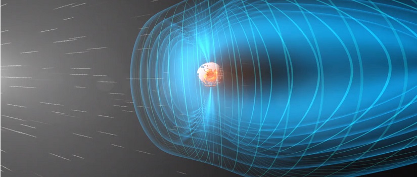
The 2015 ASEG-PESA conference was an exciting one this year. From MT to muons, the scope and depth of the presentations have been inspiring.

The two plenary speeches by ASEG president Greg Street and PESA president Max Williamson offered no euphemisms or excuses when describing the current state of our industry. With such low commodity prices, we need to prepare now for when the good times return. Whilst both proposed alternative solutions, both were in clear agreement that the time for action has come.

Without government support recovery becomes difficult, but industry reliance dampens the pathway to innovation.  To justify our worth in today's global economy, we will need both imagination and hard work to develop solutions for collecting  greater quantities of higher quality data with economy. More importantly, we must be able to communicate information more effectively and intuitively across multiple disciplines. It was made clear that today's industry leaders are already beginning to retire. Our sector is aging. This is daunting news to hear as a young career geophysicist. We will soon need more young leaders ready to carry this torch to keep our industry moving forward. I am confident we be able to develop and extend today's technology after meeting so many talented young geoscientists.

I would like to thank the ASEG for awarding me the Shanti Rajagopalan Memorial Award. I feel privileged to receive this prize. The winning paper entitled "Bathymetry, electromagnetic streamlines and the marine controlled source electromagnetic method" was written as part of my PhD work in marine CSEM and published in Exploration Geophysics. The paper investigated the influence of sea floor topography on the electromagnetic fields generated during a marine controlled source electromagnetic survey. Streamlines are an underused yet intuitive approach [...]

By |February 17th, 2015|News|0 Comments

MCSEM.com Migration

I have finally migrated MCSEM.com over to Digital Earth Lab. So I now have a single integrated website instead which is much easier for me to manage. The new MCSEM section can be found here and MCSEM.com should soon redirect to Digital Earth Lab.

Marine CSEM modelling software download, new and improved introductory chapters into marine CSEM, and archived blogposts are now accessible.

By |February 12th, 2015|MCSEM.com, News|0 Comments

Online 1D Magnetotelluric (MT) Forward Modelling (Beta)

An 1D MT forward modelling web application. Following on from the 1D MT tutorial presented earlier, the concept is taken a little further and now the simulated magnetotelluric responses can now be easily computed and displayed all from your smartphone.

This is just a beta version so far, so expect a fully functioning version in the future with more computing and display options. You can see the code's progress on my Bitbucket repository.

UPDATE: Currently this webapp keeps breaking due to server limitations and I do not wish to constantly maintain it. I am looking to move this website to a better web server to take these webapps to the next level. I would like a company to sponsor the ongoing costs so I don't have to pay for cloud compute time out of my own pocket. Any forward looking companies willing to contribute? Contact me here..

By |July 14th, 2014|Forward Modelling, Magnetotelluric, News, Web App|0 Comments

Reading Large ASCII Datasets

Ever tried reading large geophysical ASCII data sets with a standard text editor only to get angry when it hangs, crashes or runs out of memory? Chances are you don't even want to edit the document but rather want to read the first one or two lines in the header. There are several solutions to solve this problem. First of all you can load the data into a software package which imports the data directly into a database (i.e., Oasis Montaj), but that requires you to load hundreds of megabytes or even  gigabytes of data, wasting minutes in the process. Secondly, if you are 'fortunate' enough to use a Unix based OS, you can use the "less" command, great for Linux users but pretty much worthless for Windows users.

If you want to try another solution out see below.

The source code is downloadable and is licensed under WTFPL. Distribute, copy, modify, sell, integrate, delete, make erroneous.... I really don't care what you do with it. The below source code is only a sample and does not represent the complete source code.
The premise
The header in a large ASCII text file can be read by storing one line at a time in memory. This avoids memory issues and consumes mere kilobytes of memory rather than trying to import gigabytes at a time.
The Solution
I have written some code using the JDK 8 developers release SDK containing the latest JavaFX libraries. This can be run under the Windows OS. The aptly named perpetual ASCII file viewer reads a file in blocks. Using Java this is accomplished by using the lines,

BufferedReader in;
public final TextArea t = new TextArea(); //Text area displaying the read text
private int preload, bufferSize; //preload 'preload' lines and load [...]

By |April 9th, 2014|News, Uncategorized|0 Comments

Open Source in Geoscience

Like everyone else who has dealt with Open Source software and libraries I have been seriously confused over what I could and couldn't legally do and the risks associated with developing open source. I have decided to write this page to assist those who are in the starting out in earth science software licensing.

So do You Really Want to be a 'Good' Guy?
I could go on forever about virtue and consequential ethics, but doesn't the bottom line trump these principles each time? I could also go on about the many articles spouting the benefits of open source for business but is it good path to go down?

The geoscientific sector is exceptionally unique. We are a small, highly specialized industry with many different sub-specialties and it is even more in our best interest to invest in this open business model. We have all seen the result of one or two companies dominating in highly specialized areas... outrageously expensive software licenses, limitations on software and equipment use, anti-competitive behavior and subversive tactics to steal the oppositions technology whilst internalizing potentially revolutionary ideas. So is there a good reason to continue along this trajectory? It promotes monopoly, inhibits start ups, squeezes dollars out of small to mid size companies and encourages a closed stagnant industry.

On the contrary most geophysical software packages have small user bases and profiting using open source paradigms is impossible without larger industry support. At the present I believe only open seismic software developers could survive. I developed an open source electromagnetic package during my PhD and I found the experience eye opening. Over its 3 year duration and 1500+ downloads, nobody submitted any fixes to the main source code or offered financial contributions (probably [...]

By |January 13th, 2014|News, Opinion|0 Comments

Tutorial - 1D Forward Modelling (Magnetotelluric)

I constantly ask myself where the hell are the geophysics tutorials? Coming from a programming background I find the extreme lack of geophysics tutorials concerning. If you want to solve the most trivial issues in computing the internet has it covered. When you look for trivial geophysics solutions they are nowhere to be found. As geoscientists, we live in a small industry and I expect less free online resources but come on, this is ridiculous.

As a start I include the following tutorial on 1D MT forward modelling. Hopefully it is easy to follow.

...and oh yeah.... the source code is downloadable and is licensed under WTFPL. If you don't know what WTFPL is, ill give you a hint "do what the _ you want to". So in other words, distribute, copy, modify, sell, integrate, delete, make erroneous.... I really don't care what you do with it.
Introduction
The magnetotelluric (MT) method is an electromagnetic geophysical exploration technique. The technique utilizes natural sources of electromagnetic energy for very deep soundings of the earth for crustal, global, geothermal, mineral and hydrocarbon exploration.

We understand that magnetotelluric and telluric fields are large-scale low frequency electromagnetic fields generated by natural source electromagnetic source. The terms "magnetotelluric" and "telluric" are used to describe the fields and currents respectively. These MT sources generally occur outside of the earth including solar emission resulting from the diurnal variation of the earth's magnetic field (i.e., Arora's).

The point of this article is not to go in depth into MT interpretation or background but the formulation of the 1D solution. The derivation and background has been taken from several sources including Niwas et al. (2005) and Pedersen and Hermance (1986)

For a uniform geo-electrical earth the measured surface impedance is related [...]

By |December 17th, 2013|Forward Modelling, Magnetotelluric, News, Tutorial|0 Comments

Welcome to Digital Earth Lab

Welcome! Digital Earth Lab is an exciting new earth science blog covering all the interesting and controversial topics nobody seems to touch. Here at DEL we believe us earth scientists reside in a extremely litigious industry full of intellectual property lawyers and sociopaths jerks. So don't you wish we could adopt new paradigms to encourage technological advancement? As an attempt to open up the industry to new ideas we will start by amassing as many amazing open source earth science applications as we can under one roof. So please add us to your RSS feed and check back every one to two weeks for updates.


By |October 16th, 2013|News, Welcome|0 Comments

Its Been Quite a Ride

First of all thanks everyone for their continuing support and feedback.  The download counter has risen to over 1500 downloads (+/- 500 thanks to Ukrainian bots) spanning 70+ countries. It has been a rewarding experience seeing so many different people from such varied and distinguished organizations using my software. Sadly it is time for MCSEM.com to come to a close.

 
So What's Next for MCSEM.com?
I started MCSEM.com as a way to share my software and work developed as part of my PhD. So now that my PhD has finally completed I will be decommissioning this website. I will keep MCSEM.com  active and hosted for the next several years while I find a place to migrate the software and articles. I would like to migrate the software with still an existing geophysical open source consortium so if anybody has any ideas of where the software should reside please contact me.
CSEM Software From Inception...
I was 20 when I first devised of a CSEM modelling package, now at 26 I have a much clearer idea of how software should be structured and more largely the requirements for geophysical software development.  Software takes effort to create but good robust software takes dedication. I have been diligently adding to and modifying CSEMoMatic over these last 6 years and it has developed SIGNIFICANTLY from simple C code to a complex multi-dimensional Electromagnetic modelling and inversion platform written in Java. I co-wrote the first version with my friend Sean Phillips as part of his Honours Thesis for rapid generation of CSEM data for feasibility studies (Check out his work, it's a good read). The program took manual input and output the marine CSEM data into an easily importable format.

The work with Sean got [...]

By |October 1st, 2013|MCSEM.com, News, Opinion|0 Comments

SVN Access

Hi all. As you might all know the code hasn't been publically available on any proper server.

As per the GPL v3.0 license the source code is officially public. You may do as you like with it. Modify it or use it. That is now up to you. Just keep in mind if you do modify it (or incorporate a single line into you program), the program will still retain the GPL license

For the time being, I have uploaded it to an assembla SVN service.  This located may change (maybe to sourceforge.... maybe to a private SVN server.... I will decide on this later).

You can use Turtoise SVN client to download the source code.

The code isn't in the best state. It works, version 1.4 is more stable than Omnium beta. The code is largely uncommented and it's structure is too messy for my liking, this will improve. There are two different code bases. The CSEMoMatic standard (located in trunk) and the Omnium package (located in OpenWaters project). The download size is LARGE since there is quite alot of overlap between both the CSEMoMatic and Omnium so be be patient when downloading.

The SVN address is listed below,

https://subversion.assembla.com/svn/csemomatic/

Thanks all. If you need help understanding the code or compilation I am happy to help. Just send me an email.


By |September 13th, 2012|MCSEM.com, News|0 Comments

Brain Controlled Geophysics?

Because I am going to turn this into a published article I have taken a bulk of the article down I have left part of the abstract and conclusion for the interest of people.

Please see the videos at the end to see it in action. If you have any questions please contact me in the email in the footer of this page.

 
The Main Experiment: Can you use this to control geophysical software?
Proof of Concept BCI Electromagnetic Computing Case Study
Brain computer interface (BCI) systems are beginning to emerge as one of the most breakthrough technologies of the 21st century. As is the case with other developing technologies, proof of concept must be demonstrated before advanced methods are pursued. This article presents the first published case study of a brain controlled geophysical software package. Our results show that processed brainwaves from the NeuroSky MindWave electroencephalography (EEG) device can be used to control various geophysical survey parameters with an acceptable degree of accuracy and to model the corresponding data in real-time.

 
Conclusion
The results show that it is possible to control geophysical software using a BCI system..... the experiment did show some level of connection between thought level and the effect on parameter variation. The emerging field of BCI systems has many hurdles to clear before reaching functionality but we hope this pioneering proof of concept experiment demonstrates the feasibility of future brain computing applications in geophysics.

Final Word

Who cares about efficacy. Like everyone else I have decided to define success as line honours and as a result the

FIRST BRAIN CONTROLLED GEOPHYSICAL SOFTWARE IN THE WORLD WAS CREATED!***

***I have not included in my assessment possible "Skunkworks research projects" which may or may not exist in the basements of Schlumberger, Shell, BP [...]

By |August 24th, 2012|linkedin, MCSEM.com, News|0 Comments